NASA's Curiosity Mars Rover

217 readers
1 users here now

A lemmy community for scientific discussion of the Curiosity Rover and Mars Science Laboratory.

founded 6 months ago
MODERATORS
1


At the center of this image from NASA's Curiosity rover is a hole in a rock called 'Mammoth Lakes’ where the rover conducted its latest sample drilling on Mars. The drilling took place on June 19, 2024 (Sol 4219) of the rover's mission in Gale crater. Several preparatory activities with the drill preceded this operation, including a preload test on the stability of the target and the rover. The image was obtained by Curiosity's right-side mast camera on the same sol. The sample-collection hole is 0.63 inches (1.6 centimeters) in diameter, its official depth is not known at this time, but the size of the tailings (powdered rock) that surround the hole suggests the depth could be sufficiently deep enough to provide enough sample to feed into the rover's on-board instruments for detailed analysis. On the left of the hole is a bright patch where the rover had previously brushed the surface to remove the dust in order to collect data using the rover's alpha particle X-ray spectrometer (APXS). The APXS is spectrometer mounted on the turret at the end of the rover's robotic arm, and analyses the chemical element composition of a sample from scattered alpha particles.

Credits: NASA/JPL-Caltech/MSSS

2


The previous preload test failed - This one looks good as there is no apparent slippage of the bit.

MAHLI image: NASA/JPL-Caltech/MSSS

3


The Best Laid Plans… - Curiosity Rover blog for Sols 4214–4215

Earth planning date: Wednesday, June 12, 2024

Planning today was defined by the decision about whether or not to drill at "Mammoth Lakes," the potential drill target that we selected on Monday. This decision is made based on the answer to two questions. First, does this location meet our science objectives? On Monday, we undertook some exploratory contact science (primarily with APXS) to answer this question by determining the likely elemental composition of Mammoth Lakes. Second, is it safe to drill here? Monday's plan also included a "preload test" to determine the safety of drilling by using the arm to place some pressure on Mammoth Lakes. We do these activities to measure the forces we expect on the arm while drilling and to see if the rock is stable enough to drill into. Although the APXS data indicated that this location meets our science objectives, the preload test was unsuccessful. Consequently, we had to pull the drill activities from the plan.

The drill activities had been scheduled to consume the entire first sol of this two sol plan. Unfortunately, the assessment of the preload data came too late to properly pivot from a drilling sol, so we were unable to plan any observations to replace the pulled drill activities. This means that Curiosity gets to take an unplanned vacation with just REMS and RAD observations on the first sol.

The second sol looks more like a typical plan, though we had to pull a number of drill-related activities here as well, so it's a bit emptier than usual. We begin with a Mastcam tau observation looking at the amount of dust in the atmosphere, then move on to a set of Mastcam and Navcam photometry images. These photometry observations take several images of the ground near the rover at different times of day to help us understand how sunlight scatters off of the rocks around us. We take a quick break from science to let the rover communicate with Earth through the Mars Relay Network, then get right back to work with ChemCam. LIBS will be used on the target "Golden Trout Lake," then we'll get an RMI mosaic of an area about 15 metres away from the rover.

Once ChemCam is done, we'll have our second set of Mastcam and Navcam photometry observations to complement those taken earlier in the sol. We'll then take Mastcam images of the Golden Trout Lake LIBS target, one of ChemCam's AEGIS targets, and some light-toned rocks at "Camp Four." Mastcam will also be monitoring "Walker Lake," a nearby patch of sand, to see how the wind is moving the sand around.

Today's plan wraps up with a collection of environmental science activities, including a dust devil survey, suprahorizon movie, and a line-of-sight mosaic of the north crater rim, as well as our usual suite of REMS, DAN, and RAD observations.

Despite the challenges of today, we're not giving up just yet. This isn't our first failed preload test, so the team is now looking for somewhere else in this area to drill. Hopefully we won't have the same difficulties as when we were trying to drill at the Marker Band, but nobody ever said that drilling a hole in a rock from over 270 million kilometres away was easy!

Written by Conor Hayes, Graduate Student at York University

Source (with all the links and the original raw image): https://science.nasa.gov/blogs/sols-4214-4215-the-best-laid-plans/

These blog updates are provided by self-selected Mars Science Laboratory mission team members who love to share what Curiosity is doing with the public.

Dates of planned rover activities described in these reports are subject to change due to a variety of factors related to the Martian environment, communication relays and rover status.

Image credits: NASA/JPL-Caltech/MSSS

4
5


Assembled from 15 overlapping L-MastCam images using MS-ICE

Note the pair of DRT patches on the ground

DRT = Dust Removal Tool

The DRT is a rotary stainless steel wire brush, it's used to clean the surface of the rocks so they can use the APXS instrument directly on the surface, if they don't remove the dust it can skew the readings from the alpha particle X-ray spectrometer (APXS)

NASA/JPL-Caltech/MSSS

6
7


de-Bayered R-MastCam mosaic, that will eventually be part of larger mosaic, after the remaining images are downlinked. NASA/JPL-Caltech/MSSS/fredk

Make a nice screen save for a mobile phone :)

8


Just Out of Reach - Curiosity Rover blog for Sols 4209-4211

Earth planning date: Friday, June 7, 2024

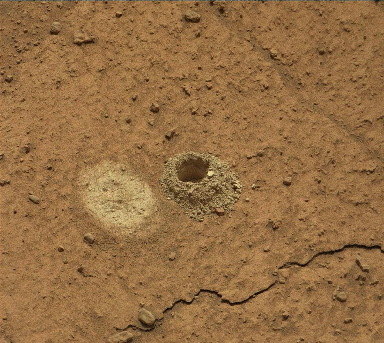
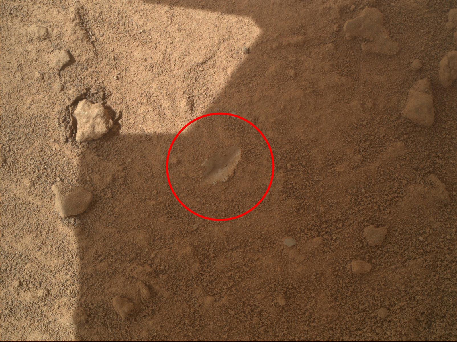
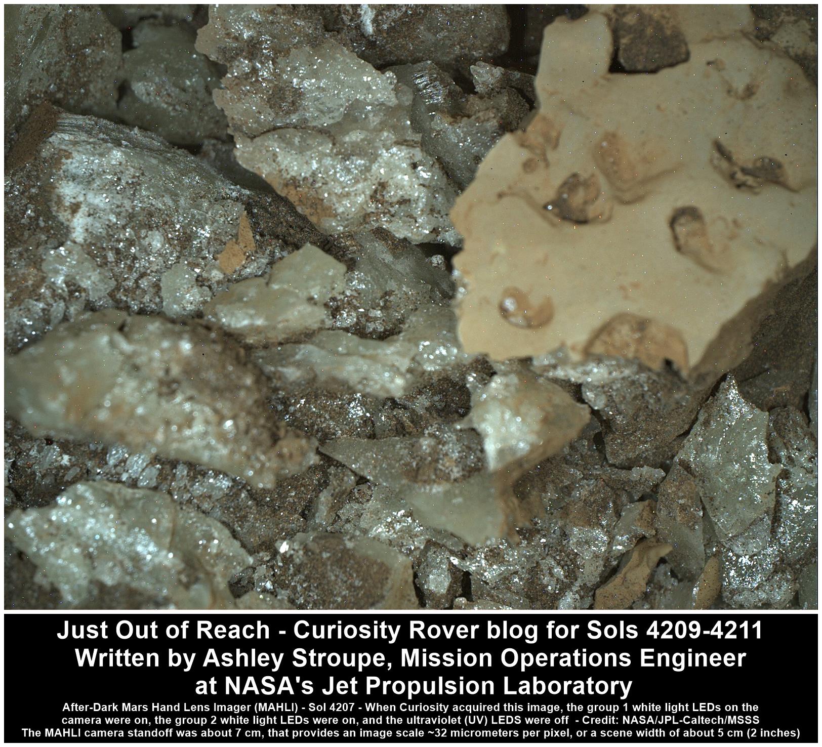
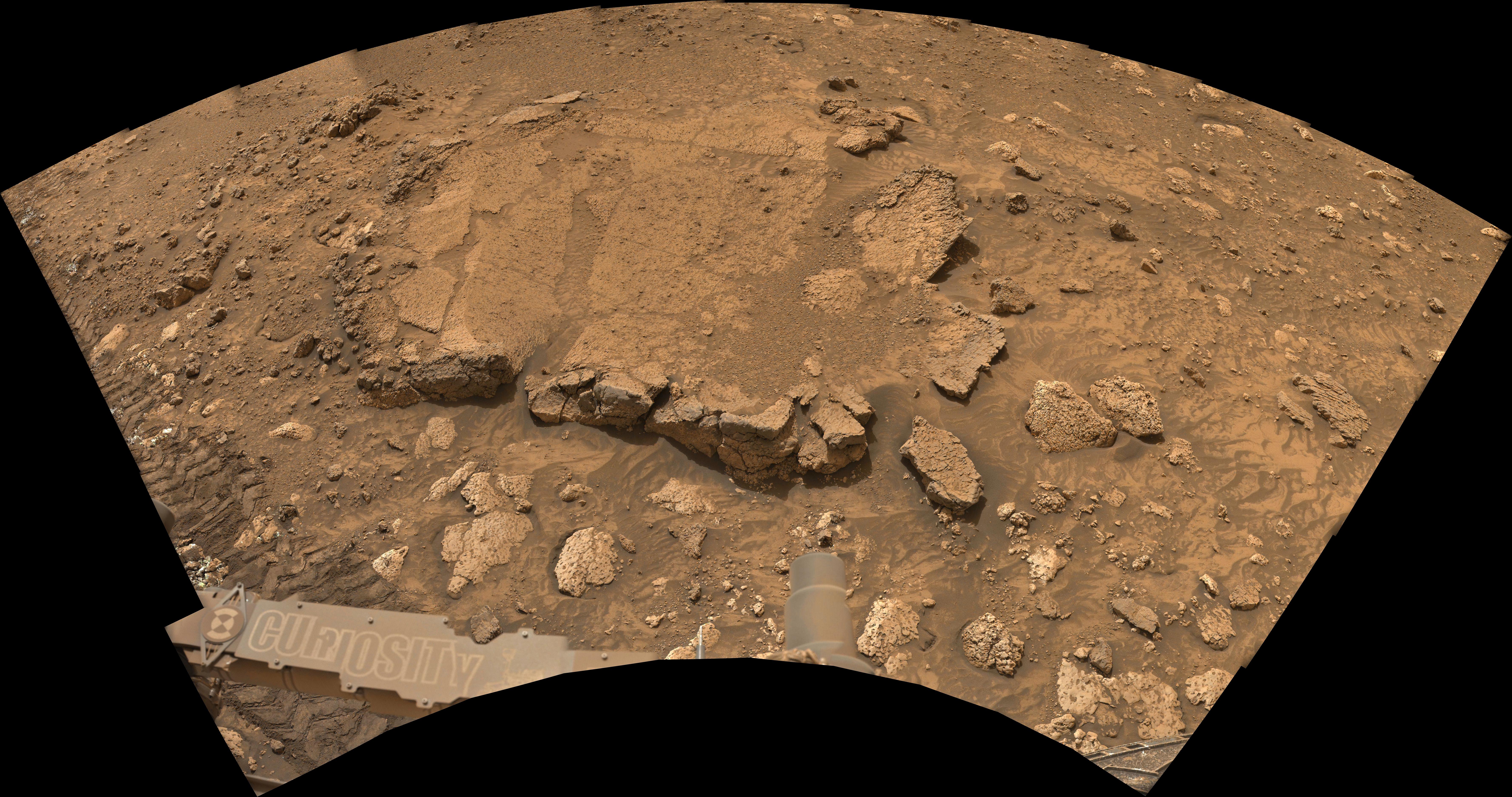
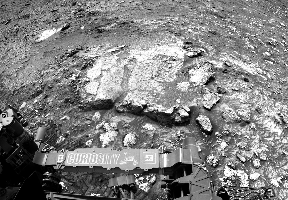
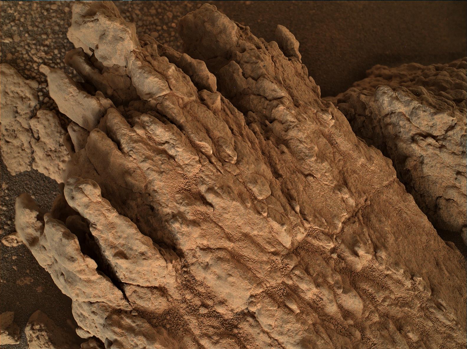
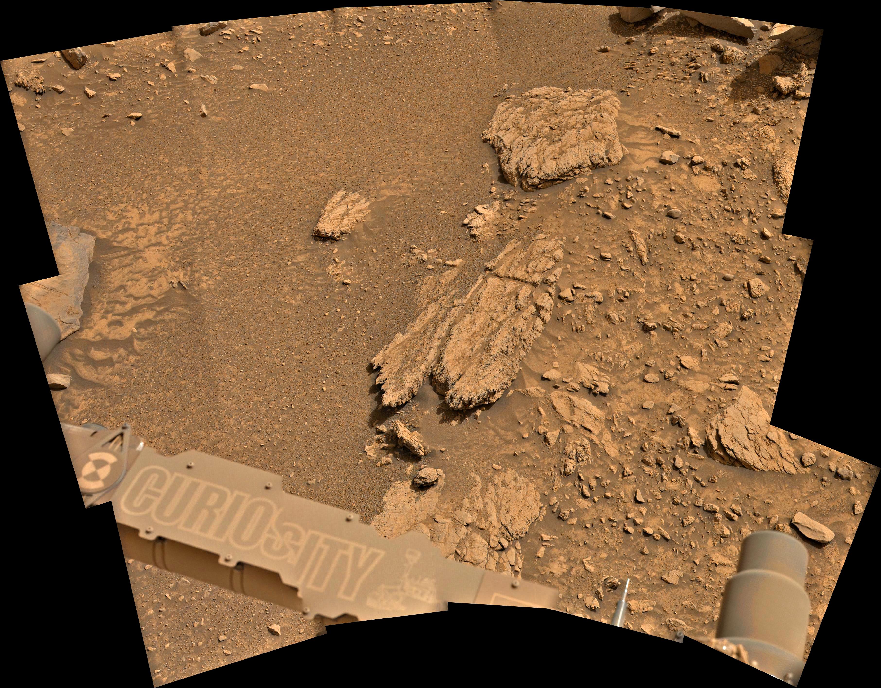
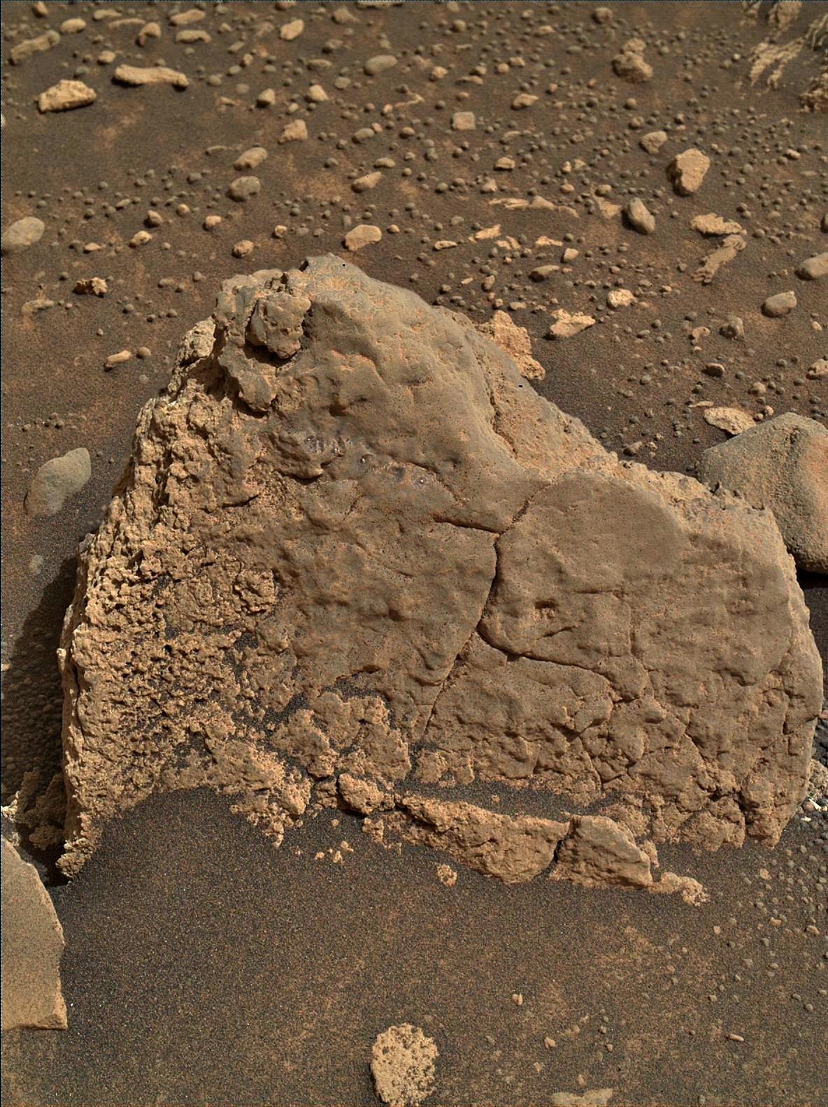
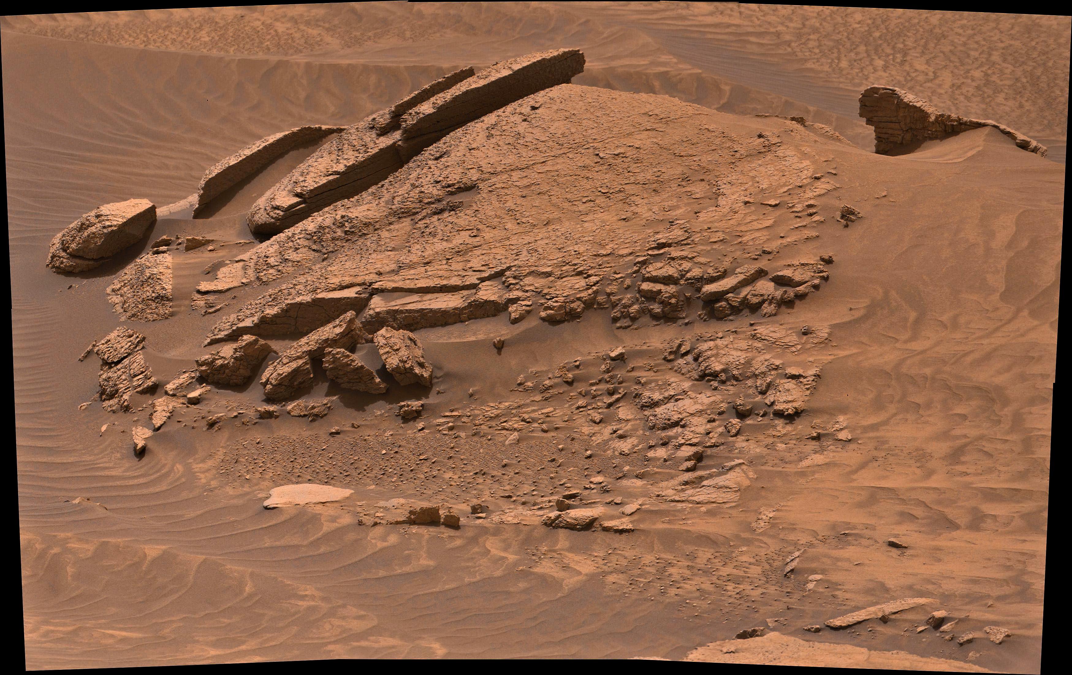
Curiosity is going to have a busy 3-sol weekend. We have one more sol of intense contact science activities at this really beautiful and fascinating location before moving on. What makes this place so special? We are seeing a lot of variety in the rocks in terms of their colors and textures. The MAHLI image is an up-close view of the unusual coloration we’re seeing, which our scientists are busy investigating. In particular, the Whitebark Pass block just in front of us, which we have been investigating for several days, is highly complex. We are evaluating it as a potential drill target, but the spots we might drill are just a little too far away from our current location. Today I am the Tactical Uplink Lead for our planning, and planning today was almost as complex as our workspace!

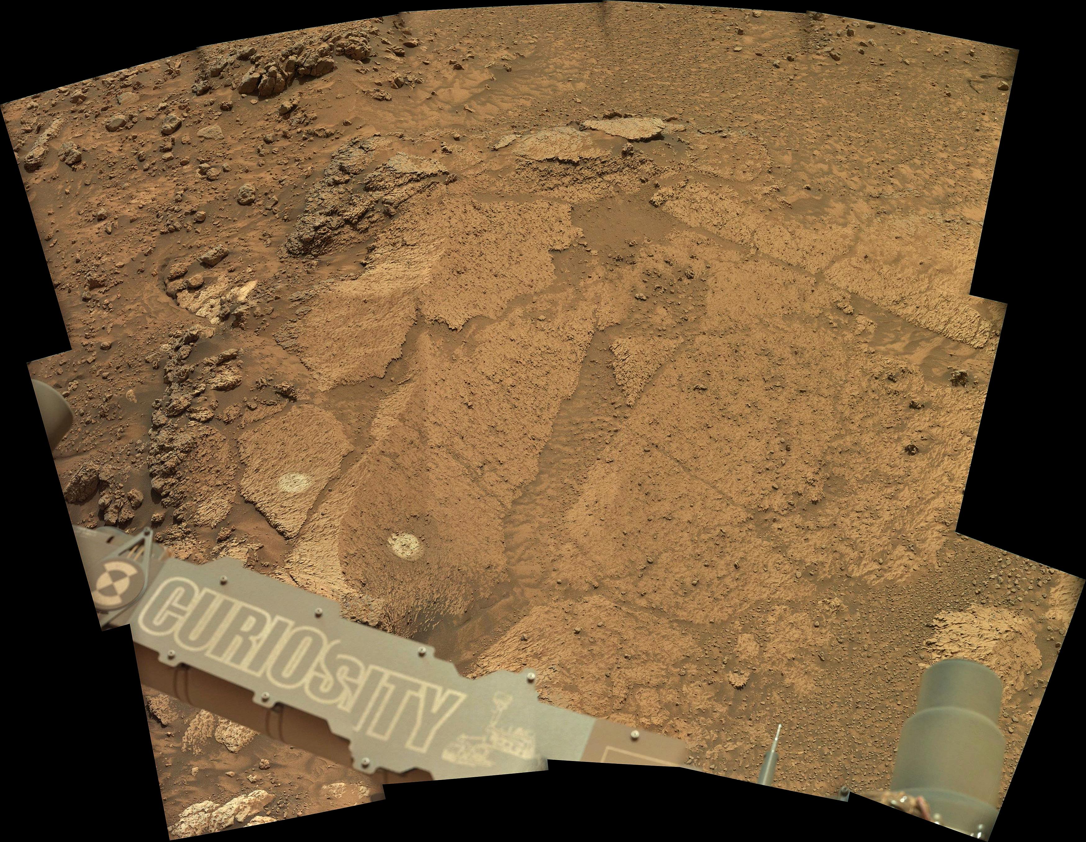
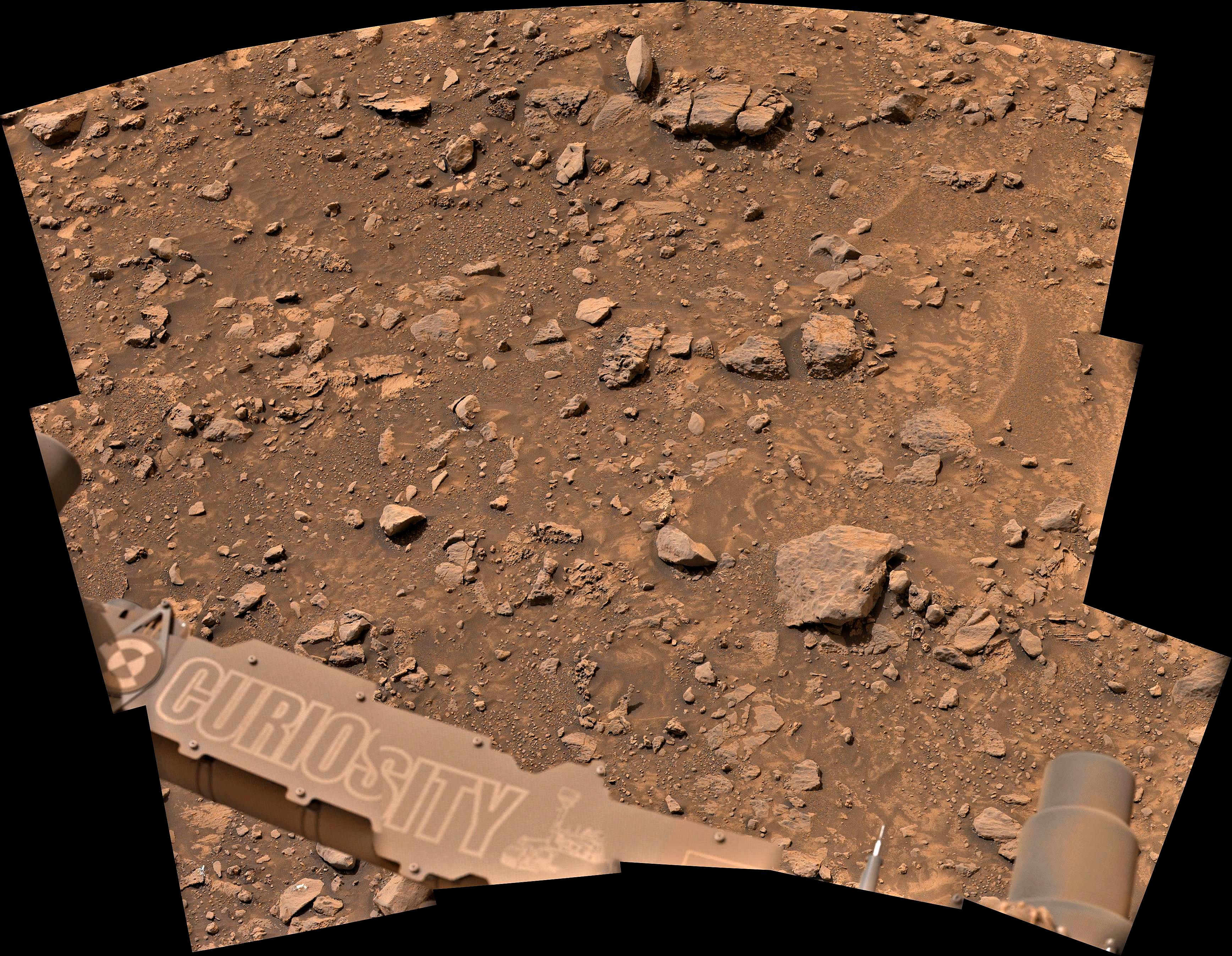
On the first sol of the plan, Curiosity begins with a lot of imaging. We begin with the first of a series of change detection images on two sand targets (“Ten Lakes” and “Walker Lake”) so that we can characterize the current wind conditions. Then, ChemCam is doing a LIBS mosaic on Rodgers Pass, which is a target on Whitebark Pass. ChemCam also takes a passive mosaic on “Devils Postpile,” which is a another light-toned rock that we can compare to the similar-looking white rocks right in front of us, and a mosaic on the bright white stone field that is about 40m northwest of us. Mastcam takes large mosaics on Recess Peak, Devils Postpile, Whitebark Pass, and the white stones, before doing another round of the change detection images. After a nap, Curiosity wakes up to do a mid-afternoon set of change detection images before going back to sleep.

After the nap, Curiosity wakes up and does a set of late-afternoon change detection images before starting our contact science. This workspace is highly complex, making it challenging to get to all of the interesting science targets, but the Rover Planners managed to get it all into the plan. First, the DRT is used to brush the Grass Lakes target before we take a suite of MAHLI images on it. Next is a suite of images on the “Snow Lakes” target, which is another white rock in our workspace. On Snow Lakes we are investigating three different spots at 5cm above the rock to look at variation within it. Throughout the rest of the afternoon and evening, the rover will wake up to move the APXS to cover all of the contact science targets, Grass Lakes and the 3 spots on Snow Lakes.

Before handing over to the next sol’s plan, we do two more early morning change detection observations. On the second sol of the plan, we do additional imaging. ChemCam takes a LIBS mosaic of Rodgers Pass and a passive mosaic of “Gem Lakes,” another target on the Whitebark Pass block. After some Navcam atmospheric observations, a dust devil survey and deck monitoring, Mastcam follows up with an image of Rodgers Pass and another set of change detection images.

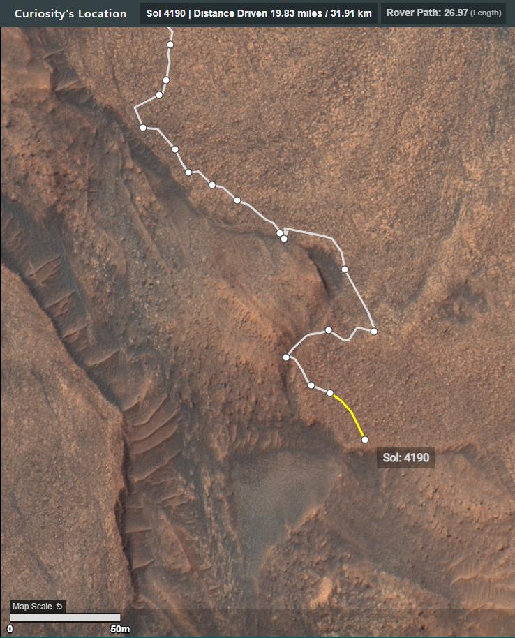
After the imaging is complete, we do a short forward drive to get more of the Whitebark Pass block into our workspace for additional contact science and evaluation as a potential drilling target. After the drive we will unstow the arm to get a better view of the new workspace as well as to save time in our next plan. After a bit of a nap, there is a MARDI image and Curiosity will go back to sleep.

On the last sol of the plan, Curiosity uses AEGIS to autonomously observe targets on Whitebark Pass after the drive. There are also some additional atmospheric images with Navcam, including a dust devil survey and suprahorizon movie. Just before handing over to Monday’s plan is a set of morning atmospheric observations, including a Mastcam solar tau, and Navcam zenith and suprahorizon movies.

Written by Ashley Stroupe, Mission Operations Engineer at NASA's Jet Propulsion Laboratory

Source (with all the links and the original raw image): https://science.nasa.gov/blogs/sols-4209-4211-just-out-of-reach/

These blog updates are provided by self-selected Mars Science Laboratory mission team members who love to share what Curiosity is doing with the public.

Dates of planned rover activities described in these reports are subject to change due to a variety of factors related to the Martian environment, communication relays and rover status.

Image credits: NASA/JPL-Caltech/MSSS

9
 
 
10


A Taste of Rocky Road - Curiosity Rover blog for Sols 4207-4208

Earth planning date: Wednesday June 5, 2024

Curiosity was still at the ice cream shop for planning today, with the delicious feast of rock flavours still at arm's reach and begging to be sampled. In the previous plan, one such flavour, captured in today's blog image and perhaps most analogous to Rocky Road (not only given that Curiosity drove over this rock causing it to fracture, but also arguably the appearance as well), caught the eye of the operations team. There was desire to place APXS on this target, "Convict Lake," in the previous plan but the team ultimately did not have the image data available that would permit Curiosity to safely do so at a suitably close distance for APXS. Not to be discouraged, Monday's operations team pivoted and utilized part of the plan to acquire images of Convict Lake that would enable better APXS placement in today's plan.

The required images for targeting Convict Lake (aka Rocky Road, just with a chocolate to marshmallow ratio that would leave chocolate lovers heartbroken) with APXS arrived just in time for planning today. These images made it possible to focus on the central task of today's two-sol plan: place APXS close to Rocky Road and target two areas that are specifically more "marshmallow" and less on "chocolate" (sorry chocolate fans).

In addition to APXS on Convict Lake, ChemCam also targeted Convict Lake using its laser and imaging capabilities. MAHLI returned for seconds (and thirds!), only this time pairing yet more daytime images with others taken at night while utilizing its illumination capabilities. ChemCam and Mastcam also imaged "Petes Col" and "Buckeye Ridge," with Mastcam additionally imaging "Camp Four," as well as "Ten Lakes" and "Walker Lake" a number of times over the course of the two-sol plan.

I for one am very excited about the particular offerings at his specific shop and what we may ultimately learn from our sampling. I, like APXS, may just have two scoops of ice cream tonight myself, perhaps even following in MAHLI's footsteps by doing so after the sun has set when nobody else is watching (we've all done it, let's be honest). Unfortunately, I do not have Rocky Road, and I think I missed my chance to have watermelon (don't knock it until you try it!).

Written by Scott VanBommel, Planetary Scientist at Washington University

Source (with all the links and the original raw image): https://science.nasa.gov/blogs/sols-4207-4208-a-taste-of-rocky-road/

These blog updates are provided by self-selected Mars Science Laboratory mission team members who love to share what Curiosity is doing with the public.

Dates of planned rover activities described in these reports are subject to change due to a variety of factors related to the Martian environment, communication relays and rover status.

Image credits: NASA/JPL-Caltech/MSSS

11


6 overlapping MAHLI images assembled using MS-ICE - Credits: NASA/JPL-Caltech/MSSS

12


You can find this small rock on the sol 4200 post a few days ago.

NASA/JPL-Caltech/MSSS/fredk

13


49 Bayer reconstructed frames from the L-MastCam assembled in MS-ICE. Credits: NASA/JPL-Caltech/MSSS/fredk

14
 
 
15


Sol 4200 post-drive - captured by Curiosity's L-NavCam (cropped / rotated mosaic)

16


Curiosity performed an onboard focus merging process during Sol 4197, creating this focus stacked product from several Hand Lens (MAHLI images that were obtained earlier the same sol, each image acquired being at different focus settings. The target is named 'Second Lake', and is located in upper Gediz Vallis in Gale crate. For scale the scene width of this processed MAHLI image is about 9.5 cm (3.74inches). The MAHLI camera is located on the turret at the end of the rover's robotic arm and was placed close to 'Second Lake' to obtain the raw images. Credits: NASA/JPL-Caltech/MSSS

17


NASA/JPL-Caltech - Roughly assembled using MS-ICE

18


MAHLI camera - standoff ~25 cm (~10 inches) NASA/JPL-Caltech/MSSS

19


NASA/JPL-Caltech/MSSS/fredk

20
21


the drive to the South continues

22
 
 
23


NASA/JPL-Caltech, assembled in MS-ICE

24


Overlapping R-MastCam images

25


10 overlapping L-MastCam images (Bayer-reconstructed)

view more: next ›